onXmaps
Trending Games
onX Hunt: Hunting Maps, Offline GPS/Nav & Weather
When it comes to trekking through the wilderness for a hunting expedition, onX Hunt stands as an invaluable ally. As a GPS navigation app designed for hunters, it provides a plethora of features – from satellite imagery and topo maps to land ownership details. It's aimed at enhancing the hunting experience by keeping you informed and on track, whether chasing game or scouting new grounds. This review delves into the multiple facets of the onX Hunt app, examining its functionality, user interface, and the impressive array of features it brings to your pocket.
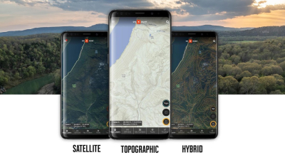
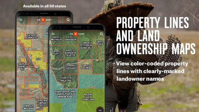
The heart of onX Hunt lies in its comprehensive mapping capabilities. Users gain access to an extensive collection of satellite and topographic maps. Its ability to overlay property lines onto the maps provides a clear and current understanding of where one can legally hunt, reducing the chance of accidental trespassing.
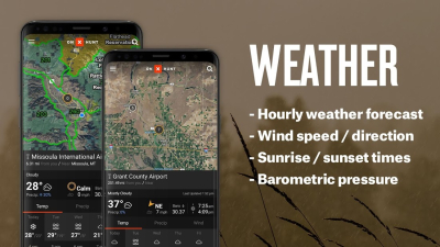
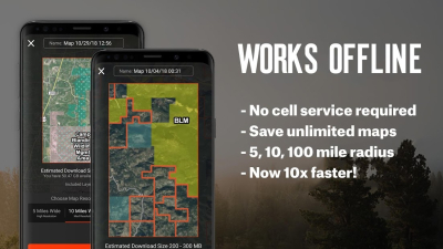
As every hunter knows, weather can make or break a hunt. onX Hunt incorporates real-time weather data into its platform so users can make informed decisions before setting out. In terms of functionality when off the grid, the app shines with its offline GPS capabilities. Users can download maps and save them for offline use, ensuring that they always have access to their location and map data, even when cellular coverage is not available.
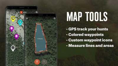
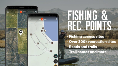
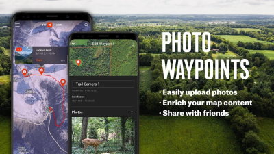
onX Hunt's interactive features are a highlight, offering users the ability to mark waypoints, measure distances, and track their movements with the click of a button. The compass mode with a rangefinder enriches the hunting experience by providing directional bearings to specific points of interest. This, along with the area measurement tool, allows hunters to effectively plan and manage their trips.
For those hunting across state lines, the two-way premium membership is a life-saver. It enables access to all the app's features for two different states, which is particularly beneficial for hunters who frequently travel. Moreover, memberships include access to onX's desktop platform, allowing for cross-device synchronization and the convenience of trip planning from the comfort of your home.
The elite-level users are treated to 3D mapping and terrain views, which offer a detailed perspective of the hunting landscape. Elite membership also provides a suite of professional offers and resources, making the service well-rounded for the most dedicated of hunters.
Pros:
- Detailed satellite and topographic maps with offline GPS functionality;
- Comprehensive land ownership data for legal hunting boundary awareness;
- Real-time weather information and forecasts;
- User-friendly interface with waypoint marking, distance measuring, and tracking tools;
- Premium membership options that cater to multi-state hunters
Cons:
- Some land ownership information may not be available for all counties;
- Premium features require an annual subscription fee, which may be a barrier for occasional hunters;
- A learning curve for those not tech-savvy might be experienced initially
All things considered, onX Hunt provides an impressive digital toolkit for hunters of all levels. With its rich maps, detailed land ownership information, and robust offline capabilities, the app is both a planning resource and an in-the-field guide. Its user-friendly interface, enhanced by powerful tools like the compass mode rangefinder and 3D mapping, makes it a top recommendation for anyone serious about hunting. For those looking to elevate their hunting game, onX Hunt seamlessly integrates modern technology with the time-honored tradition of the hunt.
To download the app, you will get links to the Official Website and/or official digital markets.


